CWC: Not Just How Green the Crop Is, but How Much Water Its Canopy Contains
How can growers detect irrigation problems early? CWC measures canopy water content and complements NDVI.
Estimated reading time: 2 minutes
CWC, or Canopy Water Content, is a remote sensing indicator used to estimate the water content of crop foliage.
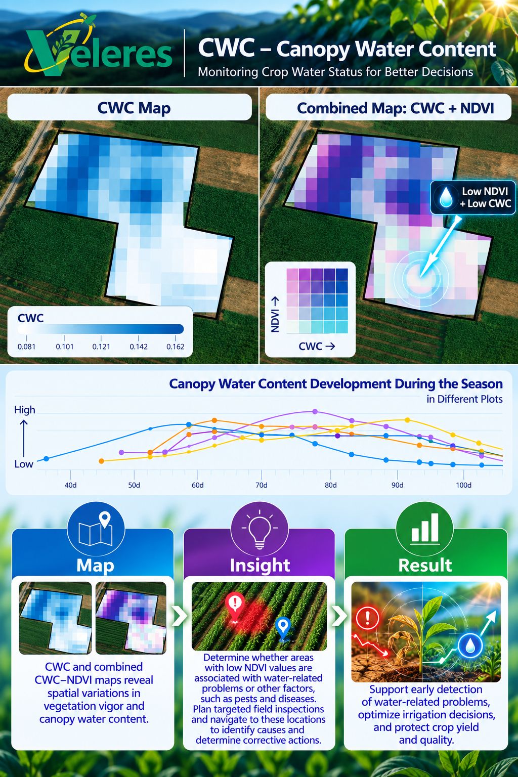
Unlike NDVI, which primarily reflects vegetation vigor, CWC provides information about canopy water status and helps identify variations across different areas of a field.
Monitoring CWC throughout the growing season can support the early detection of irrigation problems before they cause significant damage to crop development and yield.
Why Is It Important?
Monitoring CWC throughout the season allows growers to:
- Identify areas with low canopy water content compared to the rest of the field.
- Detect changes in canopy water status that may indicate irrigation problems.
- Help rule out irrigation problems as the cause of poor growth indicators, allowing growers to investigate and address other potential causes.
- Compare different fields or zones within the same field.
- Monitor changes in canopy water status throughout the season and determine whether conditions are improving or deteriorating.
- Plan targeted field inspections for early diagnosis and corrective actions.
Combining CWC with Growth Indicators: Understanding the Causes of Reduced Crop Vigor
Low NDVI values may result from various factors, including water shortages, nutrient deficiencies, pests, or diseases.
Combining CWC with NDVI or additional indices such as FCOVER and LAI helps distinguish between areas with low vegetation vigor or growth indicators accompanied by low canopy water content and areas where vegetation vigor is low but canopy water content remains relatively normal.
For example:
- Low NDVI + Low CWC: May indicate a water-related problem that requires inspection of the irrigation system.
- Low NDVI + Relatively Normal CWC: May suggest other factors affecting crop vigor, such as nutrient deficiencies, pests, or diseases.
How Does Veleres Turn Data into Action?
The Veleres platform allows growers to display CWC maps, combine them with additional measured parameters, and compare findings throughout the growing season.
When an abnormal area is identified, growers can navigate directly to its location using their smartphones, investigate possible causes, determine the necessary corrective actions, and continue monitoring to verify that the actions taken lead to improvement.
This approach helps focus field inspections on areas of concern, detect irrigation problems at an early stage, and reduce the risk of crop damage and yield loss.
In Summary
CWC adds an important dimension to understanding crop conditions: not only how vigorous the vegetation is, but also how much water its canopy contains.
Combining CWC with additional growth indicators and field inspections provides a more comprehensive understanding of crop conditions, supports better irrigation decisions, and enables earlier intervention when abnormalities are detected.
Veleres: Turning satellite data into agronomic insights and decisions that improve farming profitability.